Date: 18-11-2015
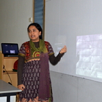
Description: Dr. M.B. Rajani of the National Institute of Advanced Studies (NIAS) presented her research on archaeological sites to illustrate the role of satellite images in understanding human history on 18th November 2015.
About the talk:
Title: What can satellites reveal about our past?
Detectives in fiction are skilled at hunting for clues and interpreting them in creative ways, thereby gaining insights into the past. Understanding human history may be somewhat less glamourous, but is nevertheless based on the same two principles: finding as rich a variety of clues and extracting as much meaning from them as possible. Past civilizations have always left material impressions of one kind or another, and it is our challenge to make these ancient materials reveal their secrets before the echoes die away forever. Scientific developments are constantly enriching the kinds of ancient materials we can regard as clues, and emerging technologies help us extract new facts from them. The talk focused on a type of clue whose value in historical inference is only just being understood: landscape. Humans have constantly modified their local environment to suit themselves. Although these changes may disappear within a few generations when observed at ground-level, they often leave lasting scars that can be observed from the vantage of satellites. These synoptic views of landscape allow researchers to study vast areas and hunt for patterns as easily as an art historian might examine a painting. Furthermore, just as a modern art historian uses technology to scrutinize what lies beneath the topmost layer of paint, satellites can view landscapes in different wavelengths and reveal hidden layers of human artefacts. Dr. M.B. Rajani used examples from her own research work on archaeological sites in India (including Belur, Halebidu, Mahabalipuram and Nalanda) to illustrate how satellite images can make landscapes speak about the past.

